Bestel3D.nl is selling licenses for ready-made elevation data. In addition, we also reconstruct buidings based on raw height data (point clouds) such as the generic Dutch Elevation dataset (AHN). We recently received the IPC innovation prize for the project described below.
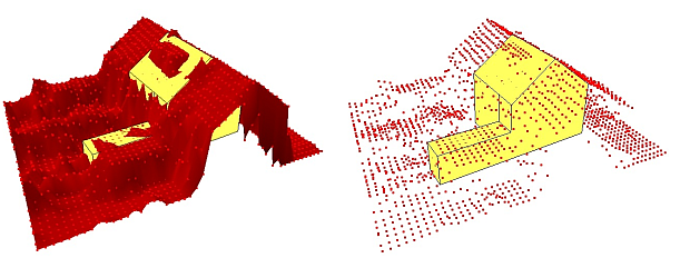
Modern data sets (point clouds recorded with help of laser altimetry techniques; i.e. AHN) feature a resolution of 8 – 20 points per square meter. 3D-reconstructions may help to retrieve detailed (rooftop) shapes, but may also retrieve simple building block representations. The image below shows a point cloud and a building geometry.
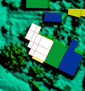
In practical terms, reconstructing buildings is not simple since height data can cover both vegetation and buildings. A distinction must be made between the two. This can be done with filtering techniques and by determining flat areas with help of segmentation techniques. In many cases, we start with available floor plans. The various objects are then split into cells.
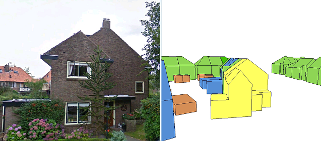
The reconstruction of buildings is not always perfect and extra modifications are often required afterwards.
3D reconstructions of buildings in Google Earth:
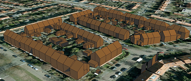
Note: Aerial image in Google Earth: (c) Aerodata.
This project has been carried out with help of an IPC-grant. Read more about 3D Reconstructions (from Laser Altimetry Data) - in Dutch.