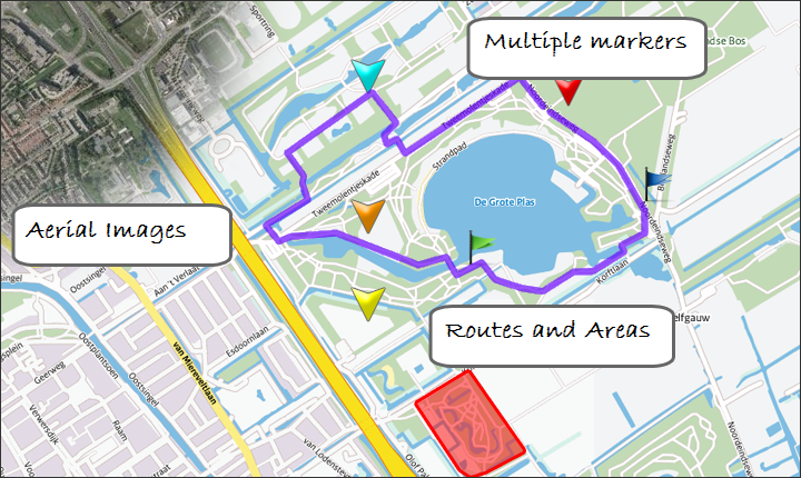
MapsAndMore is a platform for map content creation and management of digital maps and aerial images.
The system enables you to define a map. Subsequently, the map can be expanded with routes, markings and texts. Standard URL's to maps are then available for use in Twitter messages or on websites.
Make your own maps with MapsAndMore.nl.
You can test the concept on Gratis-Kaart.nl.
| MapsAndMore | Gratis-Kaart | |
|---|---|---|
| Number of layers | Infinite | One |
| Markings | Infinite | One |
| Availability map | Always | 3 Months |
| Dynamic aerial images | Yes | No |
| Routings and areas | Yer | No |
| Support | Yes | No |
Sample map: link (e.g. our office location in Delft)